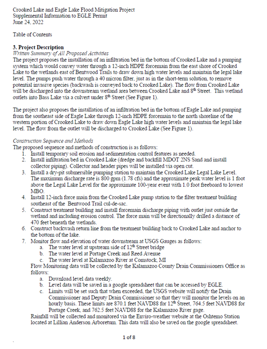
OVERVIEW
Rainfall patterns have shifted toward fewer storms that deliver significantly higher volumes. Recent years have produced 10- to 11-inch months in both spring and fall, far above the 3- to 5-inch historical averages. These events exceed the capacity of the existing 500-gallon-per-minute pump, which was not designed for the intensity or timing of modern rainfall. The lake has already demonstrated that it cannot recover between storm cycles, which increases the likelihood of overtopping, shoreline damage, and groundwater rise.
The lake’s current elevation is not simply “one foot above normal.” It is at the engineered 100‑year flood mark. This distinction is critical because it defines the level at which widespread property, infrastructure, and environmental impacts become likely. At this elevation, boat waves can overtop seawalls, accelerate erosion, and damage docks and lifts. Elevated groundwater affects homes well beyond the shoreline and places sustained pressure on foundations, septic systems, and wells. Stormwater systems lose capacity when groundwater is high, increasing the risk of street flooding and reducing drainage for upstream neighborhoods, including Pine Island, Vineyards, North Eagle Drive, and future developments.
If no action is taken, the township faces escalating risks. These include septic failures, well contamination, structural damage to homes, road and utility degradation, loss of shoreline vegetation, increased nutrient loading, and a higher likelihood of harmful algal blooms. Recreational access becomes more hazardous as beaches shrink and debris increases. Long‑term high water levels can also affect insurance assessments and regulatory requirements for shoreline properties, potentially increasing costs for residents and the township.
The situation now requires a strategic response. The lake is operating at its limit, rainfall intensity continues to rise, and the current pump system cannot restore the lake to a safe operating range. Without intervention, the township will face growing environmental, financial, and public safety consequences that will become more difficult and more expensive to manage over time.
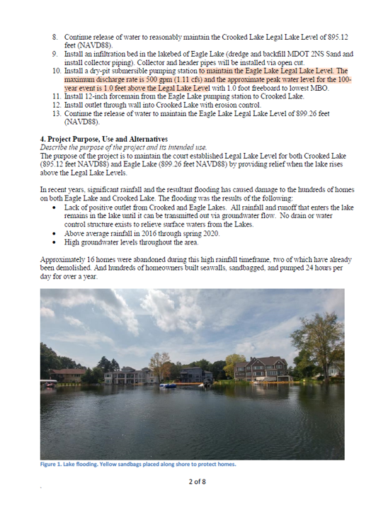
Eagle Lake Current Elevation
900.2 ft. (Normal Level = 899,26 ft.)
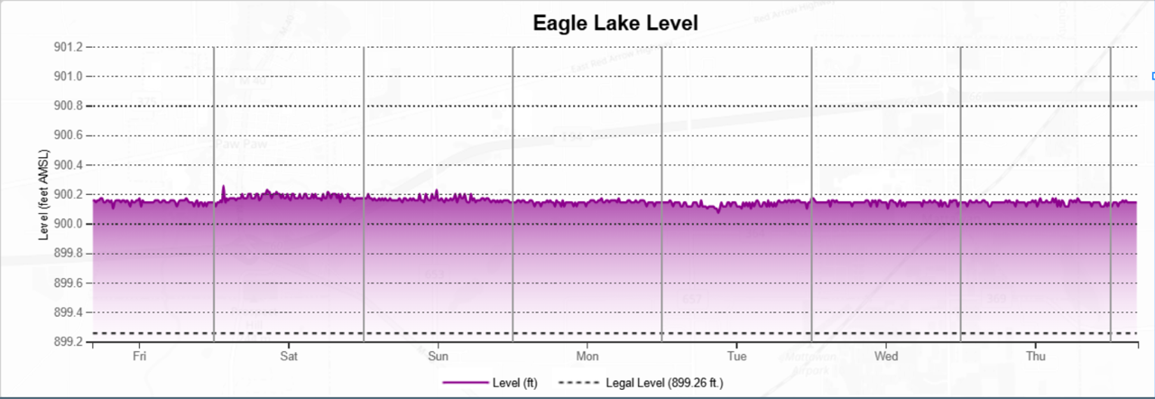
Past Rainfall Totals
Glimpse at What’s to Come
Prein & Newhof
Defines 100-Year Flood Mark